The birth of an idea
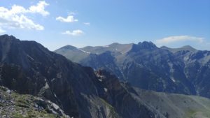
In the beginning there was a word. More specifically, Nikos Nezis’s book “Olympos”. The author of this monograph, published in 2003, indicates that there are 55 peaks on Olympus with a height exceeding 2000 m. Mount Olympus is not just one peak – as it may seem to some – but a huge massif! The asphalt road around the Mountain of Gods is 150 km long .
A few years later, in Litochoro – the main base for Olympus, a professional sports shop was created, a real mecca for all tourists and mountain changers, named nomen omen – 55 Peaks. If there are so many peaks …
And quite recently, because in the summer of 2018, in the head of Michiel Panhuysen, an idea was born: if there are 55 peaks, all of them should be run in one trial. This is how the idea of 55 Peak Project – the Greek version of FKT on Olympus – arose.

Olympic specificity
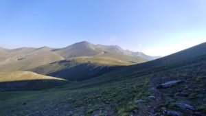
However, it’s not only about the fastest time here. The mountains in Greece are wild and inaccessible. In the lower parts grow thick, braided and stinging thickets, which can not be cross if there is no path. And there are only a few paths. There are no spiny bushes in the top parts, but there are even fewer paths. It was also a great challenge to find all these peaks. They are listed in the Nezis book, but it is not at all obvious where they are in the field, it is also difficult to find them on available maps.
The next challenge was to set the route. Olympus peaks do not form one main ridge, they are scattered quite chaotically all over the area, partly around the great and very deep Enipeas Gorge. There is therefore no natural route that would connect these peaks. It is not in the field, because for most of them there is no path. Therefore, the route should have been designated first on the map, combining successively the set of points. Known from the mathematical literature The “traveling salesman problem” is in practice unsolvable. At 55 points the number of possibilities is virtually infinite and it is not known which route is the most optimal. However, you have to choose something. In the version proposed by Michiel, the route is approximately 110 km long and 9000 m positive denivelaton.
Main Idea
The intention of the author of the whole idea and the first passage was to combine: many peaks of the vast mountain, but also people living around Mount Olympus. Therefore, from the very beginning the route was to start in Kokinopolis – a mountain village at the western foothills of the Zeus mountain and end in Litochoro – a small town on the eastern slopes, so that the reaching all peaks was also the crossing of the whole massif from west to east. 55 Peaks have also symbolic meaning. The point is to show that Olimp is not only Mytikas and Stefani – the two highest and most popular peaks. The vast majority of tourists simply want to get the highest peak in Greece. The asphalt road goes them deep up the Enipeas Gorge and the shortest route goes to the top. Along the way they have two shelters, clear and quite wide paths, sometimes even marked by signs. The rest of Olympus looks completely different. You can go many kilometers and not meet anyone. And where exactly should we meet them if there are no paths?
A detailed map of the 55 Peaks Project can be found here
All known attempts to pass 55 Peaks Project can be found here
55 Peaks Project has also his literature. You can see:
Michiel Panhuysen – 55 Peaks Project (in English) [here]
Michiel Panhuysen – 55 Peaks Project (in Dutch)
Grzegorz Olesiak – Po ścieżkach bogów na Olimpie, Ultra Nr 25/2019 (in Polish) [here]
ΘΩΜΗ ΣΟΛΔΑΤΟΥ – 55 Peaks Project: Η συνέχεια! (in Greek) [here]


